A tropical disturbance brewing in the western Gulf of Mexico is expected to unleash heavy rainfall and potential flooding across parts of Texas as it nears the coast on Friday evening, according to the National Weather Service.
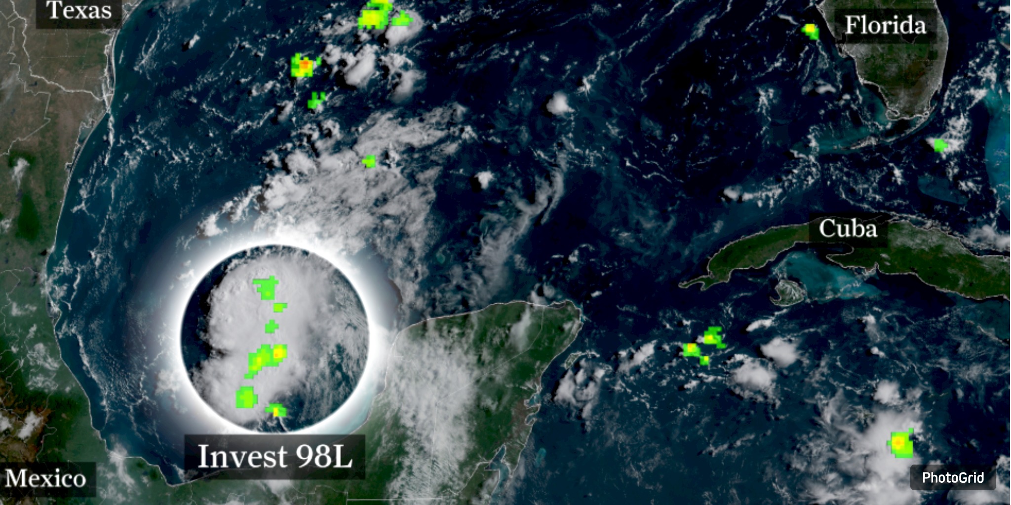
As of Thursday afternoon, the system known as Invest 98-L was situated at coordinates 21.7°N, 93.7°W. It was advancing northwest at a speed of 17 mph, with maximum sustained winds reaching 30 mph. The central pressure was recorded at 1011 millibars, suggesting that it continues to be a relatively weak system. Experts predict that it may intensify into a tropical depression or tropical storm before making landfall. If it receives a name, it will be referred to as Tropical Storm Fernand.
Late Friday, the system is poised to make landfall along the Texas coast, bringing the heaviest rain to the Brownsville and Corpus Christi regions first. As Saturday dawns, meteorologists anticipate that the rain bands associated with the system will advance inland, reaching Central Texas.
Significant rainfall accumulations are anticipated across multiple areas. Predictions suggest that La Grange is poised to experience upwards of 2 inches of rainfall, whereas San Marcos and Lockhart are expected to receive more than 1.5 inches. Austin and Georgetown are expected to receive over an inch of precipitation. While the recent rainfall is significantly less severe than the record flooding seen in early July, officials are cautioning that the rapid buildup over a short period may lead to localized flooding issues.
“Despite reduced totals, saturated soils combined with heavy rainfall can lead to perilous situations,” stated the NWS Austin/San Antonio office on Thursday.
Flash flooding poses a significant threat, particularly in low-lying regions and areas susceptible to flooding. Residents are advised to stay informed about weather developments, safeguard outdoor items, and brace for unexpected shifts in road conditions.
A significant disturbance is unfolding as Tropical Storm Erin churns in the central Atlantic, with meteorologists anticipating it may intensify into the season's first major hurricane by the conclusion of the weekend.
Tropical moisture and sluggish rain bands in Texas are combining to create a damp and potentially dangerous start to the weekend. Emergency officials are urging residents both along the coast and inland to establish flood preparedness plans and to refrain from driving through flooded roadways.


From breaking news to thought-provoking opinion pieces, our newsletter keeps you informed and engaged with what matters most. Subscribe today and join our community of readers staying ahead of the curve.
From breaking news to thought-provoking opinion pieces, our newsletter keeps you informed & engaged.


.png)